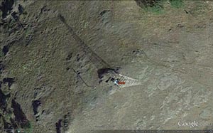
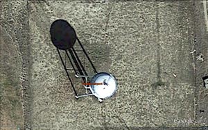
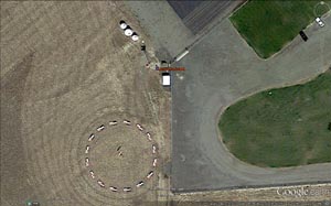
Photo from Google Earth
Yellow outline highlights the arrow shape
|
Arrow and Beacon Photos |
Site Location |
|
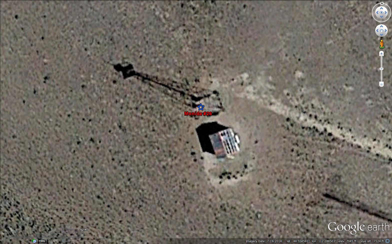 |
Considered a Montana beacon even though it is 34 feet inside of the Idaho border. We also have this site listed in Idaho.
One of 8 beacons that the FAA retained
1966. Legally transfered to the Montana Aeronautics Commission in 1977. |
26 SL-GF Monida Pass
Idaho: Clark County
CAM #26 Great Falls-Salt Lake City
Salt Lake-Great Falls airway
Pocotella-Great Falls section
National Parks Airways
National Geodetic Survey Data Sheet PZ0637
gps: 44.558610, -112.288459
|

|
|
27B SL-GF Dell DOCILF
Montana: Beaverhead County
CAM #26 Great Falls-Salt Lake City
Salt Lake-Great Falls airway
Pocotella-Great Falls section
National Parks Airways
gps: 44.732667, -112.714926
|
 |
Selected by the Montana Aeronautics Commission to remain in operation,after it was decommissioned by the FAA in January 1966. |
30 SL-GF Dalys / Canyon Resort
Montana: Beaverhead County
CAM #26 Great Falls-Salt Lake City
Salt Lake-Great Falls airway
Pocotella-Great Falls section
National Parks Airways
gps: 45.070285, -112.810795
National Geodetic Survey Data Sheet QY0531
|
 |
|
32 SL-GF Dillion DOCILF / Beaverhead County Airport
Montana: Beaverhead County
CAM #26 Great Falls-Salt Lake City
Salt Lake-Great Falls airway
Salt Lake-Pocotella section
National Parks Airways
gps: 45.252552, -112.554382
National Geodetic Survey Data Sheet QY0516
|
 |
|
34 SL-GF Twin Bridges
Montana: Madison County
CAM #26 Great Falls-Salt Lake City
Salt Lake-Great Falls airway
Pocotella-Great Falls section
National Parks Airways
gps: 45.622639, -112.277733
National Geodetic Survey Data Sheet QY0497 |
 |
One of 8 beacons that the FAA retained
1966. Legally transfered to the Montana Aeronautics Commission about 1979. |
36F SL-GF Homestake Pass
Montana: Silver Bow County
CAM #26 Great Falls-Salt Lake City
Salt Lake-Great Falls airway
Pocotella-Great Falls section
National Parks Airways
gps: 45.908223, -112.415634
National Geodetic Survey Data Sheet QY0505 |
 |
Known as Butte Municipal Airport from its opening in 1926 and then as Silver Bow County Airport from 1960-1972.
In 1972, the airport name was changed to honor Bert Mooney, the first to fly mail into Yellowstone National Park in 1935. |
37 SL-GF Bert Mooney AirportMontana: Silver Bow County
CAM #26 Great Falls-Salt Lake City
Salt Lake-Great Falls airway
Pocotella-Great Falls section
National Parks Airways
gps: 45.953774, -112.502136
National Geodetic Survey Data Sheet QY0504 |
 |
Selected by the Montana Aeronautics Commission to remain in operation,after it was decommissioned by the FAA in January 1966. |
SL-GF Ratio Mountan / Whitetail
Montana: Jefferson County
CAM #26 Great Falls-Salt Lake City
Salt Lake-Great Falls airway
Pocotella-Great Falls section
National Parks Airways
gps: 46.079891, -112.140144
National Geodetic Survey Data Sheet RX0900 |

|
|
Helena Municipal
Montana: Lewis and Clark County
CAM #26 Great Falls-Salt Lake City
Salt Lake-Great Falls airway
Pocotella-Great Falls section
National Parks Airways
gps: 46.602368, -111.994457 |
 |
Selected by the Montana Aeronautics Commission to remain in operation,after it was decommissioned by the FAA in January 1966. |
43 SL-GF Stoney Point
Montana: Lewis and Clark County
CAM #26 Great Falls-Salt Lake City
Salt Lake-Great Falls airway
Pocotella-Great Falls section
National Parks Airways
gps: 46.853737, -111.947872
National Geodetic Survey Data Sheet RW0489 |
 |
|
44 SL-GF Wolf Creek
Montana: Lewis and Clark County
CAM #26 Great Falls-Salt Lake City
Salt Lake-Great Falls airway
Pocotella-Great Falls section
National Parks Airways
gps: 47.018471, -111.963222 |
 |
Selected by the Montana Aeronautics Commission to remain in operation,after it was decommissioned by the FAA in January 1966. |
45 SL-GF HardyMontana: Cascade County
CAM #26 Great Falls-Salt Lake City
Salt Lake-Great Falls airway
Pocotella-Great Falls section
National Parks Airways
gps: 47.180643, -111.795034 |
Northern Transcontinental Airway (Seattle-Helena airway) |
 |
One of 8 beacons that the FAA retained
1966. Legally transfered to the Montana Aeronautics Commission about 1975. |
S-H Mullen PassMontana: Shoshone County
Northern Transcontinental Airway
Seattle-Helena airway
Northwest Airlines
gps: 47.479835, -115.669938 |
 |
Selected by the Montana Aeronautics Commission to remain in operation,after it was decommissioned by the FAA in January 1966. |
S-H St. Regis
Montana: Mineral County
Northern Transcontinental Airway
Seattle-Helena
Northwest Airlines
gps: 47.287258, -115.050470
National Geodetic Survey Data Sheet SU1122 |
 |
Selected by the Montana Aeronautics Commission to remain in operation,after it was decommissioned by the FAA in January 1966. |
S-H Alberton
Montana: Missoula County
Northern Transcontinental Airway
Seattle-Helena
Northwest Airlines
gps: 47.028297, -114.470372 |
 |
Beacon on control tower. |
Missoula Airport
Montana: Missoula County
Northern Transcontinental Airway
Seattle-Helena
Northwest Airlines
gps: 46.918626, -114.083744 |
 |
One of 8 beacons that the FAA retained
1966. Legally transfered to the Montana Aeronautics Commission about 1979. |
S-H University Mountain
Montana: Missoula County
Northern Transcontinental Airway
Seattle-Helena
Northwest Airlines
gps: 46.853093, -113.929115 |
 |
Selected by the Montana Aeronautics Commission to remain in operation,after it was decommissioned by the FAA in January 1966. |
43 S-H Bonita
Montana: Granite County
Northern Transcontinental Airway
Seattle-Helena airway
Northwest Airlines
gps: 46.746909, -113.622841
National Geodetic Survey Data Sheet RX1018 |
 |
|
44A S-H Bearmouth
Montana: Granite County
Northern Transcontinental Airway
Seattle-Helena airway
Northwest Airlines
gps: 46.652086, -113.268954
National Geodetic Survey Data Sheet RX0975 |
 |
Selected by the Montana Aeronautics Commission to remain in operation,after it was decommissioned by the FAA in January 1966. |
47 S-H Avon
Montana: Powell County
Northern Transcontinental Airway
Seattle-Helena airway
Northwest Airlines
gps: 46.547622, -112.636375 |

|
Mc Donald Pass listing on the National Register of Historic Places
Link to the original National Register of Historic Places Registration Form for McDonald Pass June 20, 2014
One of 8 beacons that the FAA retained
1966. Legally transfered to the Montana Aeronautics Commission about 1979. |
49 S-H McDonald Pass
Montana: Powell County
Northern Transcontinental Airway
Seattle-Helena airway
Northwest Airlines
gps: 46.556239, -112.309276 |
Northern Transcontinental Airway (Helena to Twin Cities airway) |
 |
Selected by the Montana Aeronautics Commission to remain in operation,after it was decommissioned by the FAA in January 1966. |
1 H-TC Spokane Hill
Montana: Broadwater County
Northern Transcontinental Airway
Helena-Twin Cities airway
Northwest Airlines
gps: 46.541293, -111.711802 |
 |
|
3 H-TC Townsend DOCILF
Montana: Broadwater County
Northern Transcontinental Airway
Helena-Twin Cities airway
Northwest Airlines
gps: 46.328254, -111.479654 |
 |
Red line is power line.
Selected by the Montana Aeronautics Commission to remain in operation,after it was decommissioned by the FAA in January 1966. |
5 H-TC Strawberry
Montana: Broadwater County
Northern Transcontinental Airway
Helena-Twin Cities airway
Northwest Airlines
gps: 45.969709, -111.328198 |
 |
One of 8 beacons that the FAA retained
1966. Legally transfered to the Montana Aeronautics Commission about 1979. |
6 H-TC Belgrade DOCILF/ Bozeman Airport
Montana: Gallatin County
Northern Transcontinental Airway
Helena-Twin Cities airway
Northwest Airlines
gps: 45.775236, -111.156236 |
 |

One of 8 beacons that the FAA retained
1966. Legally transfered to the Montana Aeronautics Commission in 1979. Decommissioned 1993
|
Boseman Pass
Montana: Gallatin County
Northern Transcontinental Airway
Helena-Twin Cities airway
Northwest Airlines
gps: 45.658197, -110.806923
On March 2, 1993, the Bozeman Pass Beacon was decommissioned because the Montana Power Company had erected a 180-foot radio repeater tower on the site complete with strobe lights. To avoid redundancy and confusion, the older, shorter beacon was turned off. |
 |
|
10 H-TC Livingston DOCILF
Montana: Park County
Northern Transcontinental Airway
Helena-Twin Cities airway
Livingston-Billings airway
Northwest Airlines
gps: 45.666240, -110.529071
National Geodetic Survey Data Sheet QX0728 |
 |
|
11 H-TC Mission Field DOCILF
Montana: Park County
Northern Transcontinental Airway
Helena-Twin Cities airway
Livingston-Billings airway
Northwest Airlines
gps: 45.696353, -110.453925
|
 |
|
12 H-TC Springdale
Montana: Park County
Northern Transcontinental Airway
Helena-Twin Cities airway
Livingston-Billings airway
Northwest Airlines
gps: 45.728264, -110.206060
National Geodetic Survey Data Sheet QX0657 |
 |
|
13A H-TC Big Timber DOCILF
Montana: Sweet Grass County
Northern Transcontinental Airway
Helena-Twin Cities airway
Livingston-Billings airway
Northwest Airlines
gps: 45.811007, -109.975520
National Geodetic Survey Data Sheet QW0640
|
 |
 |
13B H-TC Ross Canyon
Montana: Sweet Grass County
Northern Transcontinental Airway
Helena-Twin Cities airway
Livingston-Billings airway
Northwest Airlines
gps: 45.740491, -109.950681
National Geodetic Survey Data Sheet QW0634 |
 |
|
18B H-TC Canyon Creek
Montana: Sweet Grass County
Northern Transcontinental Airway
Helena-Twin Cities airway
Livingston-Billings airway
Northwest Airlines
gps: 45.769857, -108.915223 |
Click this link for a cool night photo. |
Beacon moved to water tower about 1950.
National Geodetic Survey Data Sheet QW0559
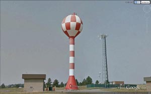
Logan field water tank is located 1 mile west of the main area of the airport and on the north side of state Highway 3. The tank is a spheroid in shape, supported by a single stand pipe and is painted red and white in color. The overall height being 100 feet. |
Billings Logan (BIL)
Montana: Yellowstone County
Northern Transcontinental Airway
Helena-Twin Cities airway
Livingston-Billings airway / Billings-Bismark airway
Northwest Airlines
Cheyenne-Great Falls airway
Casper-Billings airway / Billings-Great Falls airway
gps: 45.804400, -108.560925
National Geodetic Survey Data Sheet QW0558 |
 |
|
25 H-TC Custer DOCILF
Montana: Yellowstone County
Northern Transcontinental Airway
Helena-Twin Cities airway
Billings-Bismark airway
Northwest Airlines
gps: 46.134209, -107.508632 |
 |
|
27 H-TC Hysham Airport
Montana: Treasure County
Northern Transcontinental Airway
Helena-Twin Cities airway
Billings-Bismark airway
Northwest Airlines
gps: 46.294075, -107.195064 |
 |
|
30 H-TC Forsyth DOCILF
Montana: Rosebud County
Northern Transcontinental Airway
Helena-Twin Cities airway
Billings-Bismark airway
Northwest Airlines
gps: 46.267120, -106.612440 |
 |
|
H-TC Miles City Municipal
Montana: Custer County
Northern Transcontinental Airway
Helena-Twin Cities airway
Billings-Bismark airway
Northwest Airlines
gps: 46.427973, -105.874607 |
 |
THE CENTER OF THE ROTATING LIGHT OF THE BEACON IS THE POINT
THAT WAS INTERSECTED. IT IS 56 FEET ABOVE THE GROUND. |
37 H-TC Spring Draw
Montana: Prairie County
Northern Transcontinental Airway
Helena-Twin Cities airway
Billings-Bismark airway
Northwest Airlines
gps: 46.599499, -105.289723
National Geodetic Survey Data Sheet RT0485 |
 |
|
38 H-TC Mildred DOCILF
Montana: Prairie County
Northern Transcontinental Airway
Helena-Twin Cities airway
Billings-Bismark airway
Northwest Airlines
gps: 46.656670, -105.020070
National Geodetic Survey Data Sheet RT0481 |
Cheyenne-Great Falls airway |
 |
|
47 C-GF Patterson Canyon
Montana: Golden Valley County
Cheyenne-Great Falls airway
Billings-Great Falls airway
Northwest Airlines
gps: 46.727117, -109.184822
National Geodetic Survey Data Sheet RV0737 |
 |
|
48 C-GF Half Moon Canyon
Montana: Fergus County
Cheyenne-Great Falls airway
Billings-Great Falls airway
Northwest Airlines
gps: 46.842959, -109.262071 |
 |
Little skeleton tower on top of the watertower. |
C-GF Lewistown Municipal
Montana: Fergus County
Cheyenne-Great Falls airway
Billings-Great Falls airway
Northwest Airlines
gps: 47.046299, -109.455120
National Geodetic Survey Data Sheet SR1116 |
 |
|
53 C-GF Stanford NE
Montana: Judith Basin County
Cheyenne-Great Falls airway
Billings-Great Falls airway
Northwest Airlines
gps: 47.199359, -110.101084
National Geodetic Survey Data Sheet SS1506 |
 |
|
57 C-GF Belt
Montana: Cascade County
Cheyenne-Great Falls airway
Billings-Great Falls airway
Northwest Airlines
gps: 47.381533, -110.884449 |
Airports / Unknown airway |
 |
|
Anaconda / Bowman Field
Montana: Deer Lodge County
gps: 46.147267, -112.865259 |
 |
One of 8 beacons retained by the FAA in
1966. Legally transfered to the Montana Aeronautics Commission about 1977. |
B3 Ramsay / Silver Bow
Montana: Silver Bow County
gps: 46.051845, -112.712405
National Geodetic Survey Data Sheet RX0926 |
 |
|
Lincoln Airport
Montana: Lewis and Clark County
gps: 46.958170, -112.647490 |
 |
Top of water tower |
Chester Airport
Montana: Liberty County
gps: 48.508893, -110.978908
National Geodetic Survey Data Sheet RX0900 |
 |
On hanger
|
Choteau Muni
Montana: Teton County
gps: 47.821386, -112.169702
National Geodetic Survey Data Sheet ST0479 |
 |
|
Cut Bank International Airport
Montana: Glacier County
gps: 48.606322, -112.366548
National Geodetic Survey Data Sheet TM0790 |
 |
|
Columbus Airport
Montana: Stillwater County
gps: 45.630368, -109.232986 |
 |
|
Three Forks Airport
Montana: Gallatin County
gps: 45.883536, -111.565538 |
 |
|
Roundup Airport
Montana: Musselshell County
gps: 46.471706, -108.549872 |
 |
|
Laurel Airport
Montana: Yellowstone County
gps: 45.700522, -108.761424 |
 |
|
Terry Municipal Airport
Montana: Prairie County
gps: 46.778730, -105.305788 |
 |
|
West Yellowstone Airport
Montana: Gallatin County
gps: 44.685657, -111.115479 |
 |
|
White Sulpher Springs AirportMontana: Meagher County
gps: 46.500283, -110.906188 |
This site provides historical information only, do not use for navigation purposes.
Arrows and Beacons may be on private property, DO NOT TRESPASS!
ALL photos are copyrighted and may not be used without written permission,
other than for personal use.
Arranged by CAM Route and Beacon #. This is a work in progress and will be constantly updated as new information is found. |